 |
|
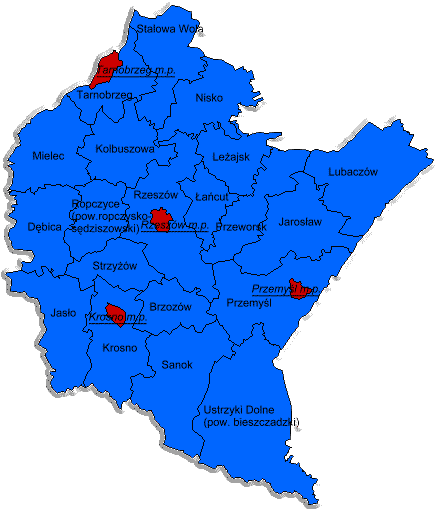
Podkarpackie Province |
|
|||||
| Podkarpackie | ||||||||
|
||||||||
| |||||||||||||||||
|
In our context here, structure is mean to be geo-political structure. First - I.E. how does a province come about? Here's the answer, thanks to Marie Dallas, PolandGenWeb Country Coordinator. ""Powiat" is a Polish term which roughly translates to "district." Poland's interior is divided into 16 wojewodztwa (provinces - more accurately voivodships). Each woj. is divided into powiaty - in the case of Podkarpackie, there are 20 powiaty. It's kind of like a U.S. state being divided into counties. Each powiat is further divided into gminy (municipalities), and there can be several villages within a gmina. These terms are political in nature. A gmina is the lowest level of governmental divisions." For details of 1 Jan 1999 restructuring of Poland's 49 provinces into 16, refer to Poland: The 49 Provinces, 1975-1998. Thanks Marie. Second - What about the structure prior to 1975 ? This comes from some background supplied by Marge Galus Sandlier in reply to a query about an individual (Here's a link to the full text of the response as it appears in the list archives).
We can't even begin to described the excitement this brings. Especially when the history "story" can be translated to actual historical documents, some of them online at Vital Records for Galician Towns. My quick search didn't reveal anything, but we are sure it will for some who review. We look forward to any reports, and thanks again Marg. We also welcome any further clarification, details or links about geo-political structure. You can contribute using Feedback.
This
page created: 9 June, 2002. Last updated:
04 September, 2007 11:51:36 +1000
|
| ||||||||||